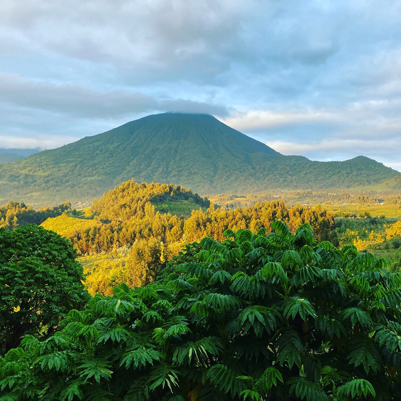
The Mount Karisimbi hike is a two day, one night trek to the 4,507 metre summit of Rwanda’s highest volcano, starting at the Kinigi headquarters of Volcanoes National Park. Day one climbs through bamboo and hagenia forest to a camp at about 3,700 metres; day two brings a cold, steep summit push and a long walk down. It is strenuous but needs no climbing skills. Hikers must be 15 or older, buy a Rwanda Development Board permit and walk with a park guide and armed escort.

Mount Karisimbi Hike Facts at a Glance
Most people who climb Karisimbi are already near Musanze for gorilla trekking, and many book it with only a vague idea of what the two days involve. The panel below pulls the numbers together. Where published sources disagree, it gives the range.
The detail that surprises people most is the gap between distance and effort. Fourteen kilometres sounds like a day walk. On Karisimbi it is mud, roots, steep volcanic soil and thin air, and the clock matters far more than the map.
Karisimbi Trek Start: Kinigi Briefing, Trailhead and Armed Escort
Every Karisimbi trek starts at the Kinigi park headquarters, the same compound where gorilla trekking groups gather each morning. Arrive by 7am with your passport. Staff check documents against the permit at the gate, and RDB warns that wrong names, an expired passport or the wrong product can mean refused entry even after you have paid.
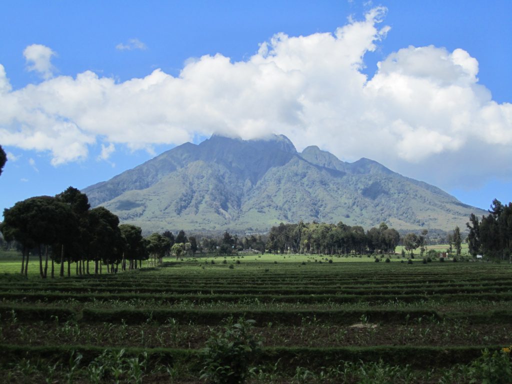
After the briefing the group drives west to the trailhead below Mount Bisoke. The final stretch of road is rough and badly rutted, and at times part of it has been washed out, so guides sometimes start from a different point and rejoin the usual trail higher up. A high clearance 4×4 is the right vehicle. Allow thirty minutes to an hour. If you came by bus or shared taxi, arrange the transfer with your lodge or a driver the evening before.
Karisimbi hikers walk with a park guide and a team of armed rangers or soldiers, sometimes ten or more for a small group. Guides say the escort is there for forest buffalo, which do live on these slopes, and that is true, yet the volcano also sits on the border with the Democratic Republic of Congo, and the security reflects that too. Small parties are often merged so one escort covers everyone, so you may share the trail and the camp with strangers.
The group moves at the pace of its slowest member. Fit hikers can find day one slower than they expected; slower hikers should never feel hurried. Porters wait at the trailhead to carry packs, tents and food, and on this climb they are worth every cent. Most groups end up as a small caravan of hikers, porters, a cook, the guide and the escort.
Day One of the Karisimbi Hike: Bamboo, the Saddle and Camp
Day one of the Karisimbi hike runs from farmland at the park edge to the camp at about 3,700 metres, and it takes most groups six to seven hours with a picnic lunch on the way. You cross potato and pyrethrum fields, step over the stone buffalo wall that marks the park boundary and climb into the forest.
The first band is bamboo, dense and often dripping. Above it the trail reaches the saddle between Bisoke and Karisimbi, where it winds through open hagenia and hypericum woodland hung with moss and lichen. This is buffalo and golden monkey country, and close to the site of Dian Fossey’s Karisoke research camp, whose name joins the start of Karisimbi to the end of Bisoke.
Then comes the mud. Trip reports disagree about plenty on Karisimbi, but almost every one mentions the mud on the lower and middle trail, ankle deep after rain and sticky enough to pull at every step. Some hikers wear tall rubber boots for this section. Others manage in boots with long gaiters and accept wet socks.
Higher up, the trees open and the trail steepens through giant lobelia and tree senecio. Breathing gets harder and conversations shorten. Camp usually appears in the middle or late afternoon, which leaves time to pitch tents, eat and warm up before dark.
Not every group follows that order. With a strong party and clear weather, some guides push on to the summit on the afternoon of day one, sleep at camp and walk out the next morning in a few hours. Ask your operator which plan your guide prefers.
Camping on the Karisimbi Trek at 3,700 Metres
The overnight camp on the Karisimbi trek sits near the upper limit of the trees, at about 3,700 metres. Forget any picture of a mountain hut with bunks. The site has simple open sided structures with wooden floors and corrugated metal roofs, and hikers pitch tents underneath them, which helps more than you would think when hail and thunder roll through at night. The escort sleeps in a separate building.
There is no shop, no water tap and no rental counter. Everything you sleep in, eat and drink comes up with you or your porters, including firewood, carried from below because cutting trees inside the park is forbidden. Operators running the trip normally supply tents, a cook, food and water; independent hikers have to organise all of it. Toilet facilities are very basic, so carry toilet paper and a bag to pack it out. Phone signal comes and goes, and there is no electricity, so bring a charged battery pack.
Nights are cold. Hikers who brought a light sleeping bag describe lying awake in every layer they owned. Temperatures around camp can fall to freezing, and water left outside can ice over. A bag rated to a few degrees below zero, a sleeping mat, a warm hat and dry clothes sealed in a bag for the evening make the difference between rest and a long shiver.
Go to bed early. The summit call comes in the dark.

Summit Day on the Karisimbi Climb: Branca Caldera and the Descent
Summit day on the Karisimbi climb begins between about 4am and 5.30am, depending on the guide and the sky. Most kit stays at camp. You climb with a daypack, water, warm layers and a head torch, and the last 800 metres or so of height usually take around two hours.
This is the hardest stretch of the trek. The trail leaves the trees for steep, loose volcanic ground, tussock grass and alpine moorland, and in places it gains height very fast. Wind picks up. Cloud often sits on the upper slopes, and hail, sleet or a thin coat of fresh snow can fall near the top even in the dry months. Each breath reminds you of the altitude.
The top itself catches people off guard. A telecommunications mast and a small building stand on the summit, and the sign marking Mount Karisimbi sits near them, with the true high point a short walk to the north. On a clear morning the view runs west over the forests of Congo to Mikeno and the other Virunga volcanoes, east across Rwandan farmland, and sometimes southwest to Lake Kivu. Plenty of groups reach the top inside cloud and see very little; nobody can promise a view.
Southeast of the summit lies the Branca caldera, about 2 km across, and to the south the Muntango crater. Your guide decides how long you stay, usually twenty to thirty minutes, because wind and cold make lingering miserable.
Then the descent. Back at camp there is breakfast, the tents come down and the group retraces the route. This leg takes five to six hours and punishes knees and ankles, above all in the mud, where most people fall at least once. Poles help. A dry change of clothes waiting in the vehicle helps more. Most groups reach the trailhead in the afternoon, with time to get back to Kinigi or Musanze before dark.
Karisimbi Hike Difficulty, Altitude and Fitness
How hard is the Karisimbi hiking trip? Every source rates it strenuous, and the reason is the combination: long hours on steep, slippery ground, a night at 3,700 metres, then a dawn climb to 4,507 metres. Few visitors to Rwanda have ever slept that high, and the ascent from Kinigi happens fast, in little more than a day.
Altitude deserves respect. Headache, poor sleep, nausea and breathlessness are common above 3,500 metres. A few habits lower the risk: spend a night or two around Musanze or Kinigi, which already sit high, before you climb; walk slowly; drink plenty; and tell the guide early if a headache gets worse or you feel confused or unsteady. Going down is the cure, and guides will turn a hiker around when needed.
Many hikers use the one day Mount Bisoke hike to its crater lake, at about 3,700 metres, as a test a day or two before Karisimbi. Same park, similar mud, similar height for a few hours. If Bisoke leaves you wrecked, take that seriously.
For fitness, long hill walks with a loaded pack in the weeks before you fly do more than any gym session, and stairs work if you live somewhere flat. You do not need to be an athlete. You do need to be comfortable walking uphill for six hours and then doing it again the next morning on poor sleep. Anyone with a heart or lung condition should see a doctor before booking.
Karisimbi Hiking Route, Distance and Map Landmarks
The standard Karisimbi hiking route is an out and back trail from the Bisoke side of the park, so the way down is the way up. There is no signposted map at the trailhead and no option to wander off it, because the escort keeps the group together, but knowing the landmarks helps you pace yourself.
Distance figures for the Mount Karisimbi hike vary more than almost anything else about it. Some park guides quote about 7 km each way, others about 12 km each way, and GPS logs posted by hikers run past 20 km for the full trip, partly because the start point moves with the state of the road. Plan around time instead: a full day up, a few hours to the top, most of a day down.
Best Months for the Karisimbi Hike and Mountain Weather
The best months for a Karisimbi hike are the two drier seasons, June to September and December to February. Trails are firmer, the summit is clear at dawn more often and the descent is less of a slide. Rain can still fall in any month, because the volcano makes its own weather.
The wetter seasons run from March to May, with April usually the wettest, and from October to November. The park stays open and climbs go ahead, but expect deeper mud, more cloud at the top and a colder, damper night at camp. A few hikers like these months for quieter trails; the price is that the summit view becomes a gamble.
| Month | Rain | Trail | Verdict |
|---|---|---|---|
| January | Low | Fair | Good |
| February | Low | Fair | Good |
| March | Rising | Muddy | Fair |
| April | Highest | Very muddy | Hard |
| May | High | Very muddy | Hard |
| June | Low | Firm | Best |
| July | Lowest | Firm | Best |
| August | Low | Firm | Best |
| September | Low | Fair | Good |
| October | Rising | Muddy | Fair |
| November | High | Very muddy | Hard |
| December | Falling | Fair | Good |
Read the chart as a packing guide too. From June to August, plan for clear, cold nights and bring your warmest layer for the summit. In the wet months, add rubber boots or long gaiters, full waterproofs and dry bags for the sleeping bag. Whatever the month, dawn on the summit sits somewhere around freezing, and the white cap the mountain is named for, hail or light snow after a storm, can appear in any season.
Gorilla trekking follows the same seasons, so the dry months are also the busiest for permits. The best time for gorilla trekking guide covers the same rains from the Bwindi side.
Karisimbi Hiking Permits and Booking Through RDB
You need a Karisimbi hiking permit from the Rwanda Development Board to climb. Permits are sold online through RDB’s booking portal on a first come, first served basis and issued automatically once the application and payment go through. Each hiker’s full name, passport details, email and phone number are needed, so check them twice; RDB states that wrong, incomplete or false details can lead to refused entry even with a paid permit.
Rates differ by visitor category: foreign visitors, foreign residents of Rwanda, East African citizens, foreign residents of East Africa and Rwandan citizens each pay a different amount, with lower student and child rates for some groups. Resident rates need at least four consecutive months of residency or a work permit in your passport. The figures are in the FAQ below, and the wider fee picture is in our Rwanda gorilla permits guide.
The permit covers the hike and the park guide. It does not cover transport to Kinigi and the trailhead, tents, sleeping bags, food, a cook, porters or tips. That gap is why most climbers book the Karisimbi trek through a licensed operator, who buys the permit, sends the vehicle and handles the camp, and some companies sell Karisimbi only as part of a longer Rwanda trip. To compare operators who run Volcanoes National Park itineraries, start with our list of gorilla safari companies.
Karisimbi permits rarely sell out the way gorilla permits do. Book ahead all the same, especially for the dry months, because porters, escort and camping kit need arranging, and because the climb has to fit cleanly around your gorilla date.
Packing for the Karisimbi Trek: Gear for Mud and Freezing Nights
Packing for the Karisimbi trek is half gorilla trekking kit and half high camp kit. The lower trail is wet forest; the top is cold, windy moorland. This is what guides and returning hikers keep recommending.
If you are short on kit, our guide to renting trekking gear explains what can be hired locally, and the Rwanda gorilla trekking packing list covers the clothing you will reuse with the gorillas.
Wildlife and Vegetation Zones on the Karisimbi Hiking Trail
A Karisimbi hiking trip crosses nearly every vegetation band the Virungas hold, which is half the reason to do it. You start in farmland, pass through bamboo, climb through hagenia and hypericum woodland and a belt of giant heather, and finish in the afro alpine zone of giant lobelias, tree senecios and tussock grass below the bare summit cone.
Golden monkeys live in the bamboo and are sometimes seen from the trail. Forest buffalo leave tracks and dung across the saddle, and once in a while the escort has to move one off the path. Birders should watch for Albertine Rift species such as the Rwenzori turaco and handsome francolin, plus sunbirds working the lobelias higher up.
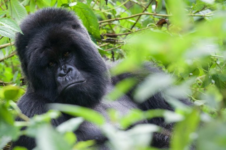
Mountain gorillas are a different story. The Karisimbi gorilla family, which split from the Susa group, ranges on the lower slopes of this volcano, and hikers now and then pass fresh dung or old nests. Seeing the gorillas themselves on a Karisimbi hike is rare and should never be expected; the only reliable way to spend time with them is a separate gorilla trekking permit. If golden monkeys matter to you, book the dedicated golden monkey trek instead of hoping for a sighting on the way up. Dian Fossey’s tomb at Karisoke is also a separate hike with its own fee, not part of the Karisimbi route.
Mount Karisimbi Volcano Facts: Height, Country and Eruption History
Karisimbi is the highest of the eight volcanoes in the Virunga Mountains, the chain shared by Rwanda, Uganda and the Democratic Republic of Congo. At 4,507 metres it is Rwanda’s highest point and is usually listed as the eleventh highest mountain in Africa, though some guides rank it higher. Which country is Mount Karisimbi in? Both: the summit sits on the Rwanda and Congo border, with Volcanoes National Park on the Rwandan side and Virunga National Park on the Congolese side.
It is a large stratovolcano, now dormant. No eruption has been recorded in human history, and volcano databases place its last activity roughly ten thousand years ago, a date marked as uncertain. Its neighbours are Bisoke to the east and Mikeno across the border to the north, with Nyiragongo, one of the world’s most active volcanoes, further west above Goma. Lava flows and small cones spread across the plains below.
The name is usually traced to amasimbi, the Kinyarwanda word for snow, and is often translated as white shell. It refers to the white cap the summit sometimes wears after hail or snow showers, which comes and goes with the storms.
The volcano also holds a place in gorilla history. In 1967 Dian Fossey founded the Karisoke Research Center on the saddle between Karisimbi and Bisoke, and the work she began there continues through the Dian Fossey Gorilla Fund.
Combining a Karisimbi Climb With Gorilla Trekking in Rwanda and Bwindi
Most climbers pair the Karisimbi climb with gorilla trekking, and the order matters. Do the gorillas first, or leave at least one rest day after Karisimbi. Two long days on the volcano leave legs stiff, and a gorilla trek in Volcanoes National Park can take anything from under an hour to several hours of steep walking each way. Booking them on back to back days is possible, but it is the plan people most often regret.
In Rwanda everything runs from one base. You can trek gorillas from Kinigi one morning, rest or climb Bisoke, then start Karisimbi from the same headquarters. With the gorillas you get one hour with the family, and guides ask you to keep about 7 metres away. Our Rwanda gorilla trekking guide covers the families, the briefing and fitness, and our Volcanoes National Park overview lists the park’s other activities.
Crossing into Uganda is just as easy. Bwindi gorilla trekking in the southern Rushaga and Nkuringo sectors, or a Mgahinga gorilla trek on the Ugandan side of the same volcanoes, sits four to six hours by road from Kigali through the Cyanika border, closer still from Musanze. A popular plan is Karisimbi and Rwanda’s gorillas first, then a cross border transfer for a second gorilla trek or the longer gorilla habituation experience in Bwindi. See our Bwindi gorilla trekking guide and the page on trekking Bwindi from Kigali for routes and timing.
Karisimbi also works as a test run. Hikers eyeing Kilimanjaro use it to find out how they cope with sleeping above 3,500 metres before committing to a week on Africa’s highest mountain, and the Rwenzori Mountains in western Uganda offer a longer, wetter test nearby. Our seven day Rwanda safari shows one way to fit the volcano into a wider trip.
Getting to Volcanoes National Park for the Karisimbi Trip
International flights land at Kigali International Airport. From Kigali, Kinigi is about two and a half hours by road through Musanze on a good tarmac highway. Most hikers arrive the day before, sleep near the park and leave early for the 7am report time. Lodges around Kinigi range from simple guesthouses to the luxury lodges near Volcanoes National Park, and many will arrange the trailhead transfer for you.
Coming from Uganda, the Cyanika border near Kisoro is the closest crossing to the park, with Katuna further north on the Kabale road. Our getting there guide covers flights, road routes and border crossings for the whole gorilla region.
Mount Karisimbi Hike FAQ
How much does a Mount Karisimbi hike permit cost?
RDB lists the Karisimbi permit at US$400 for foreign adults, US$250 for foreign residents of Rwanda (US$180 for students and children), US$300 for East African foreign residents, US$200 for East African citizens and RWF 30,000 for Rwandan adults. The permit covers the hike and the guide. Porters are usually about US$20 each, tips for guides, porters and the escort are customary, and operators add transport, tents, food and a cook, so ask for a written list of inclusions before comparing quotes.
How difficult is the Mount Karisimbi hike?
It is strenuous but not technical. Expect six or seven hours of steep, muddy walking, a cold night at 3,700 metres and a dawn climb to 4,507 metres. Hikers who train with long hill walks and hire a porter usually manage; complete beginners should try Bisoke first.
Can you do the Karisimbi hike in one day?
Not as a standard trip. The park runs Karisimbi as a two day climb with a night at camp, and operators book it that way. A very strong group may reach the summit on the first afternoon, but plan and pay for two days.
When did Mount Karisimbi last erupt?
No eruption has been recorded in human history. Volcano databases put its last activity roughly ten thousand years ago, a date flagged as uncertain, and the mountain is treated as dormant.
Can I rent sleeping bags and gear for Karisimbi?
Some operators and shops around Musanze rent sleeping bags, jackets and boots, and walking sticks are handed out at Kinigi. Check what is included before you travel and bring your own warm layers if you can.
What happens if the weather is bad on Karisimbi?
The guide decides. Groups usually climb in rain, but storms, lightning or very poor visibility near the top can mean turning back short of the summit. Ask your operator about refund and rebooking terms before you pay.
Will I see mountain gorillas on the Karisimbi hike?
Probably not. The Karisimbi gorilla family lives on the volcano and hikers sometimes pass dung or nests, but sightings on the trail are rare. Book a gorilla trekking permit if seeing gorillas is the goal.
Is the Karisimbi hike safe given the Congo border?
The Rwandan side is patrolled, and every Karisimbi group walks with a guide and an armed escort. Check your government’s current travel advice for the border area before you go, and follow the guide’s instructions on the summit, which sits right on the border.
Can children or older travellers do the Karisimbi climb?
The minimum age is 15. There is no upper age limit and fit hikers in their sixties do finish it, but anyone with heart, lung or knee problems should get medical advice first and consider Bisoke instead.
How difficult is the gorilla trek in Rwanda?
Easier than Karisimbi. A gorilla trek in Volcanoes National Park can take from under an hour to several hours each way, on steep and often muddy slopes, and rangers try to match fitter visitors with families that range further. Porters and walking sticks help, and the minimum age is 15.
How many days do you need for gorilla trekking in Rwanda?
The trek itself takes one day, and a one day gorilla trip from Kigali is possible. Two or three days is more comfortable, and adding Karisimbi needs at least three more, counting a rest day.
Is gorilla trekking in Rwanda worth it, and what does a permit cost?
For most people, yes: an hour with a habituated mountain gorilla family is the reason many travel to Rwanda at all. A Rwanda permit costs US$1,500, with RDB’s 30 percent offer bringing it to US$1,050 from November to May when you add nights in Nyungwe or Akagera. In Uganda, a Bwindi or Mgahinga permit is US$800 for foreign non residents, with a US$600 rate in April, May and November. See our guide to Uganda gorilla permits.